Boost Yields with Drone Technology
Improve your yields and protect your farm’s bottom line with Harvest Aerial’s cutting-edge agricultural drone services. From efficient, uniform application of pesticides and fertilizers to critical insights from high-definition multi-spectral imaging, our technology makes it easier than ever to maximize yields, prevent drift, and crop loss, to keep your operation running as smoothly as possible. Contact us today to revolutionize your farming operation.
Boost Your Yields With Us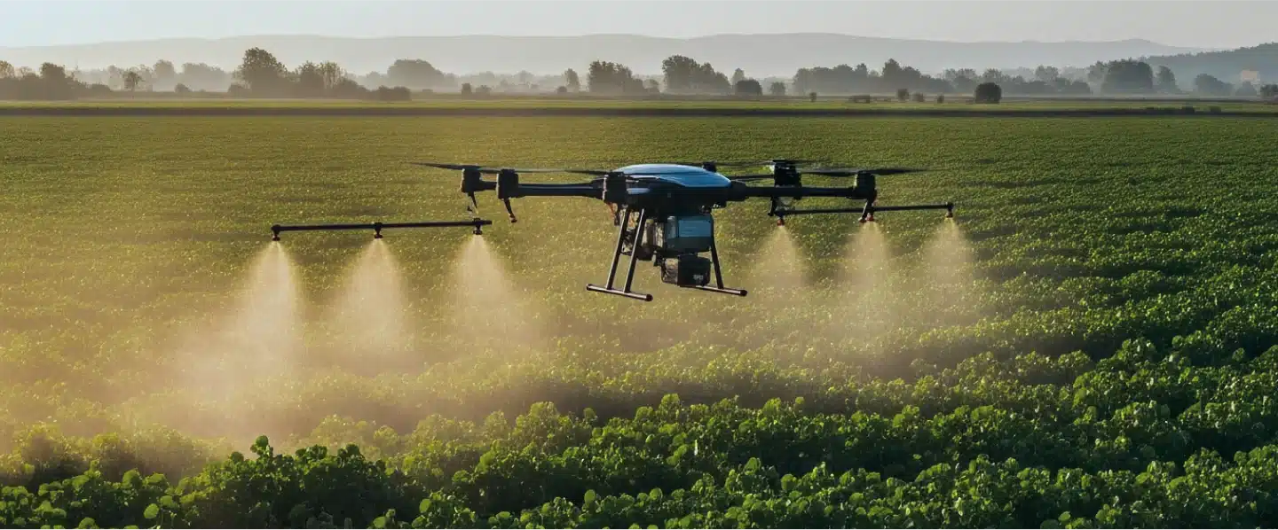
Agricultural Drone Services & Mapping
Harvest Aerial leverages modern drone technology to help farmers improve yields and efficiency, better understand and address crop issues, and keep their operations protected from drift incidents, USDA violations, crop loss, and other adverse events. Harvest Aerial Solutions is licensed, certified, and insured to provide the following aerial services.
Fertilizer & Pesticide Application
We deliver efficient, uniform coverage that conforms to all Federal and State regulations and supports stronger yields. Our application process is designed to support sustainable farming practices.
Precise and Uniform Seeding
You tell us what you need planted, and our automated drone technology ensures not only proper coverage but also proper seed positioning. No issues with wet fields, no unnecessary soil compaction and none of the limitations of larger aircraft.
Stunning, multipurpose imagery
Aerial drone photography allows operators to easily assess storm damage, identify infrastructure problems, and address security concerns. Our photography is also great for marketing and other promotional purposes.
Unparalleled Insights for Farmers, Ranchers, and Landowners
From color-coded crop health indicators to thermal imaging that allows for accurate herd counts, pest location, or any of your land management needs. Harvest Aerial’s multispectral imaging provides critical insights to keep your operation in the black.
Comprehensive Terrain Mapping
Understand your property’s terrain like never before. Our 3D mapping service gives you the lay of your land like you’ve never seen it, with topographical data and detail to prepare for any project or task from infrastructure development to finding property lines or additional planting acreage.
Drone Field Services
Unparalleled support
Harvest Aerials commitment to bringing leading edge technologies to Kentucky small businesses and landowners means that we will work with researchers, owners, and other businesses to provide drone support platforms to your work. We will work with you to develop data collection programs and platform specific solutions so you can focus on your research while we do the flying.
Benefits of Drone Application
All-Terrain Accessibility
No slope is too steep, no area is too small or large, and no field is too wet for our drones.
Reduced Drift
No slope is too steep, no area is too small or large, and no field is too wet for our drones.
Integrated Pest Management (IPM)
No slope is too steep, no area is too small or large, and no field is too wet for our drones.
Aerial Application Process
Our process can be broken down into 3 simple steps:01

Tell Us What You Need
Specify the product you want us to apply. We can work with nearly any USDA-approved pesticide, fertilizer, or seed. You will need to provide the products in the desired amount and ensure they meet USDA standards prior to application.
02

Tell Us Where You Want It
Show us the exact area you want your product applied, and any other relevant application instructions. After receiving precise direction, Harvest Aerial ensures all application operations conform to USDA standards.
03

Fulfillment & Benefits
With the product and the area defined, we use drone technology to precisely and thoroughly apply the product to the specified area, protecting your harvest, improving yields, and protecting your bottom line.
Join the Farming Revolution
Have questions about our aerial drone services? Contact us today and we’ll get them answered.