Multispectral Imaging for Smarter Crop and Herd Management
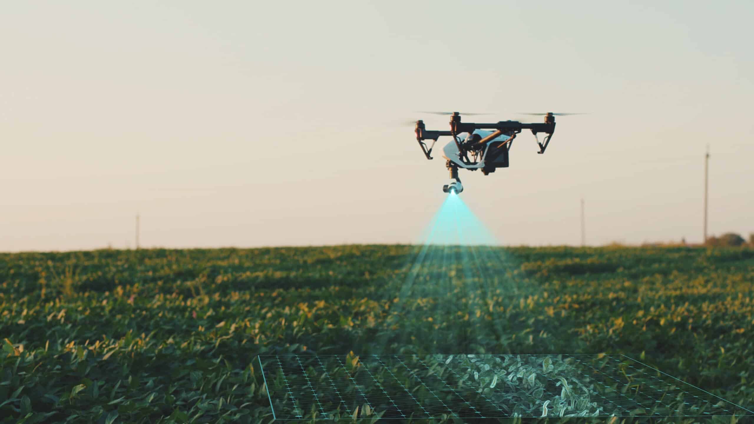
Multispectral drone imaging is a powerful tool that allows farmers to see what the human eye cannot. By using specialized sensors, our drones capture multiple types of imagery in a single flight, giving you a deeper understanding of crop health, field variability, and livestock presence.
In simple terms, multispectral imaging works by capturing several different “views” of your fields at the same time. Instead of just a standard photo, the drone collects data from multiple light bands, including red, green, blue, near-infrared, and thermal. These combined images reveal plant stress, growth patterns, and heat signatures that help you make better, faster management decisions.
RGB Crop Imaging
Our drones capture high-definition red, green, and blue imagery using a specialized multispectral sensor. This RGB data helps farmers visually assess crop health at a cellular level, making it easier to identify early stress, uneven growth, or nutrient deficiencies often before they are visible to the eye.

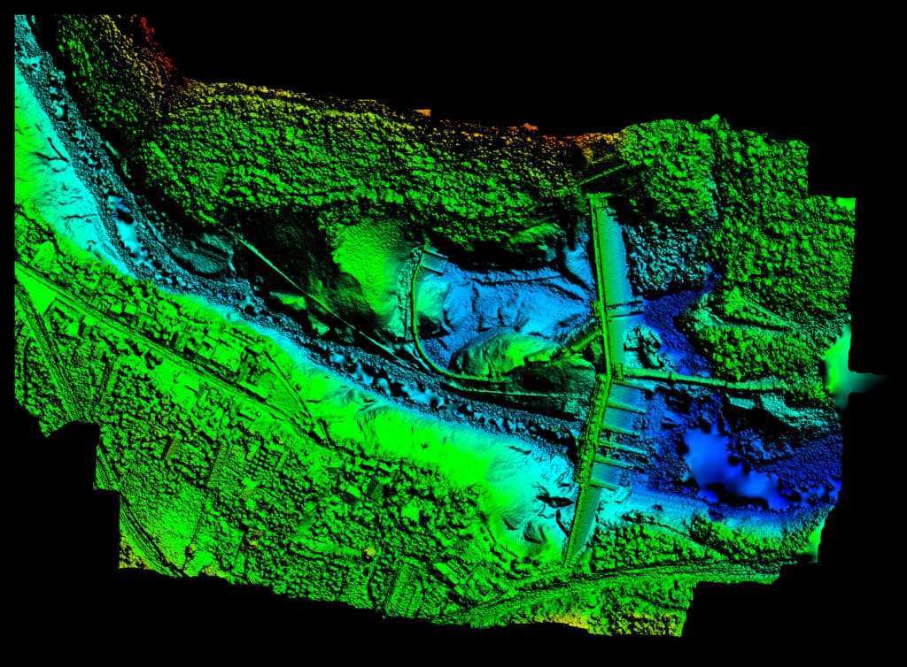
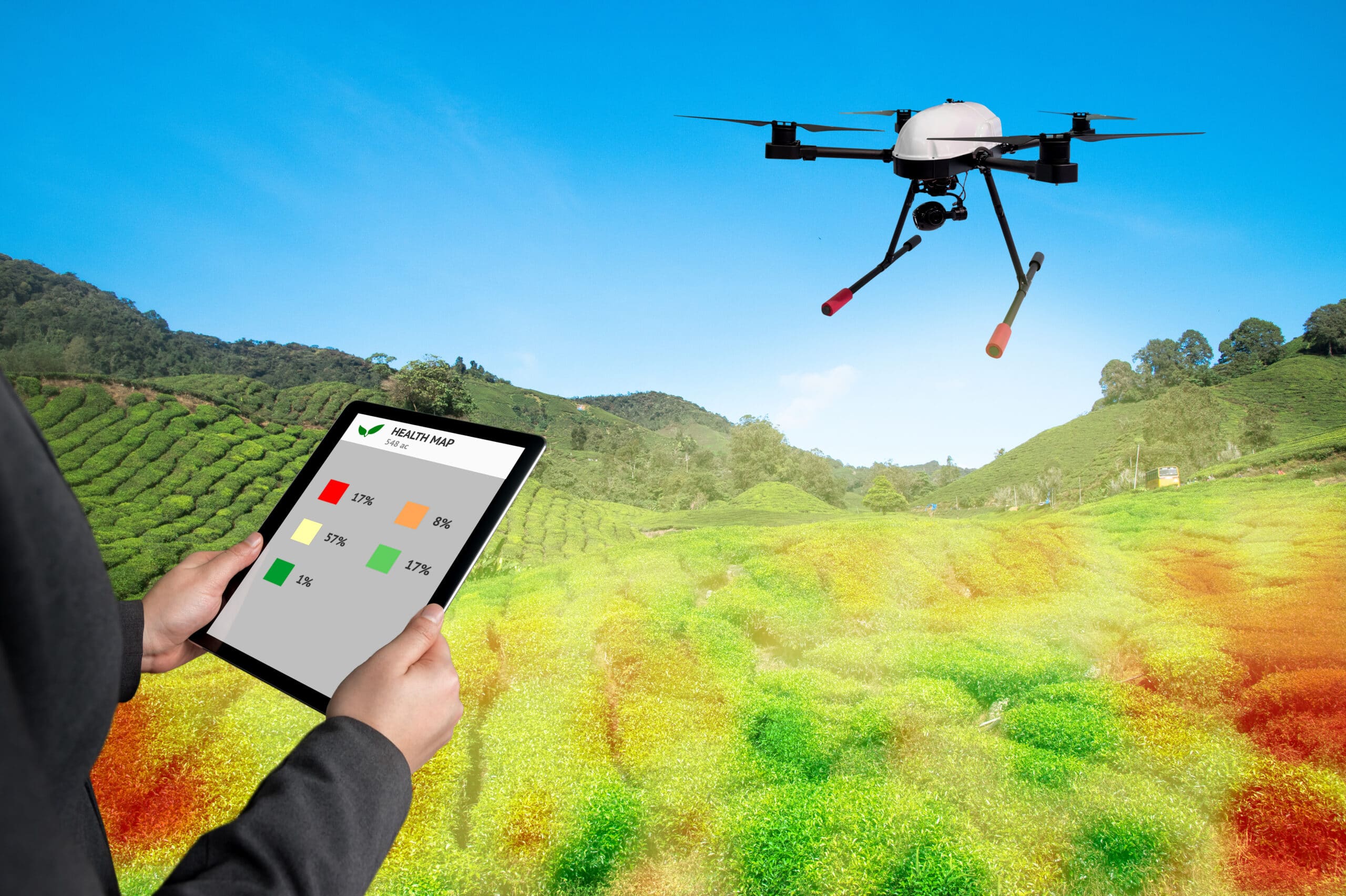
Five Images in One Flight
Multispectral imaging delivers five distinct data layers in a single pass over your field. This includes standard RGB imagery, additional spectral bands for plant analysis, and thermal data, all collected simultaneously to provide a complete picture of field conditions without multiple flights.
Crop Health & Stress Detection
By analyzing how plants reflect different wavelengths of light, multispectral imagery highlights areas of stress caused by pests, disease, nutrient shortages, or water issues. These insights allow you to address problems early and apply inputs only where they are truly needed.
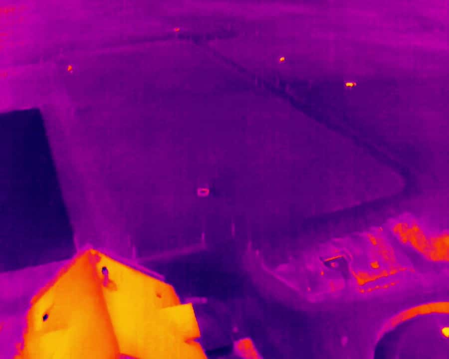
Thermal Imaging for Herd Counts
Thermal imaging detects heat signatures, making it an effective tool for accurate herd counts. Whether monitoring livestock across large pastures or locating animals in dense cover, thermal data provides fast, reliable visibility that traditional visual methods often miss.
Thermal Imaging for Pest Intelligence
Similar to herd counts, thermal imaging is an effective tool for accurate intelligence on pests like feral pigs. Locating animals in dense cover, thermal data provides fast, reliable visibility that land owners can act on in real time to address pests damaging their property.
Our services
Contact Us
follow us on
Customer Questions
What is multispectral imaging, in simple terms?
Multispectral imaging is a way of seeing beyond normal photos. The drone captures several types of light at once, showing how plants are growing, where they may be stressed, and how heat is distributed across crops or livestock.
What kind of images will I receive?
You’ll receive high-resolution RGB images, additional spectral imagery for plant analysis, and thermal images. Together, these provide five data layers from a single flight.
How does multispectral imaging help improve yields?
By identifying problem areas early, multispectral imaging helps you scout more efficiently so that you can identify the problem faster, target fertilizer, irrigation, and pest control more precisely. Combined with precision application methods, multi-spectral imaging reduces waste and improves overall crop performance.
Can multispectral imaging be used throughout the growing season?
Yes. Flights can be conducted at multiple stages of growth to track crop development, compare progress over time, and support in-season management decisions.
How long does a typical imaging project take?
Most multispectral imaging projects can be completed in 1–2 days, weather permitting, with processed data delivered shortly after flight.