High-Resolution 3D Mapping for Smarter Farm Decisions
Harvest Aerial’s drone-based 3D mapping services give farmers a detailed, data-rich view of their land. Using advanced aerial sensors and mapping software, we generate accurate 3D models that reveal elevation changes, drainage and erosion patterns, and field variability that are impossible to see from the ground.
These maps support better planning, improved water management, and more efficient use of inputs. Whether you’re preparing for planting, addressing drainage issues, or managing long-term land improvements, aerial 3D mapping delivers actionable insights you can trust.
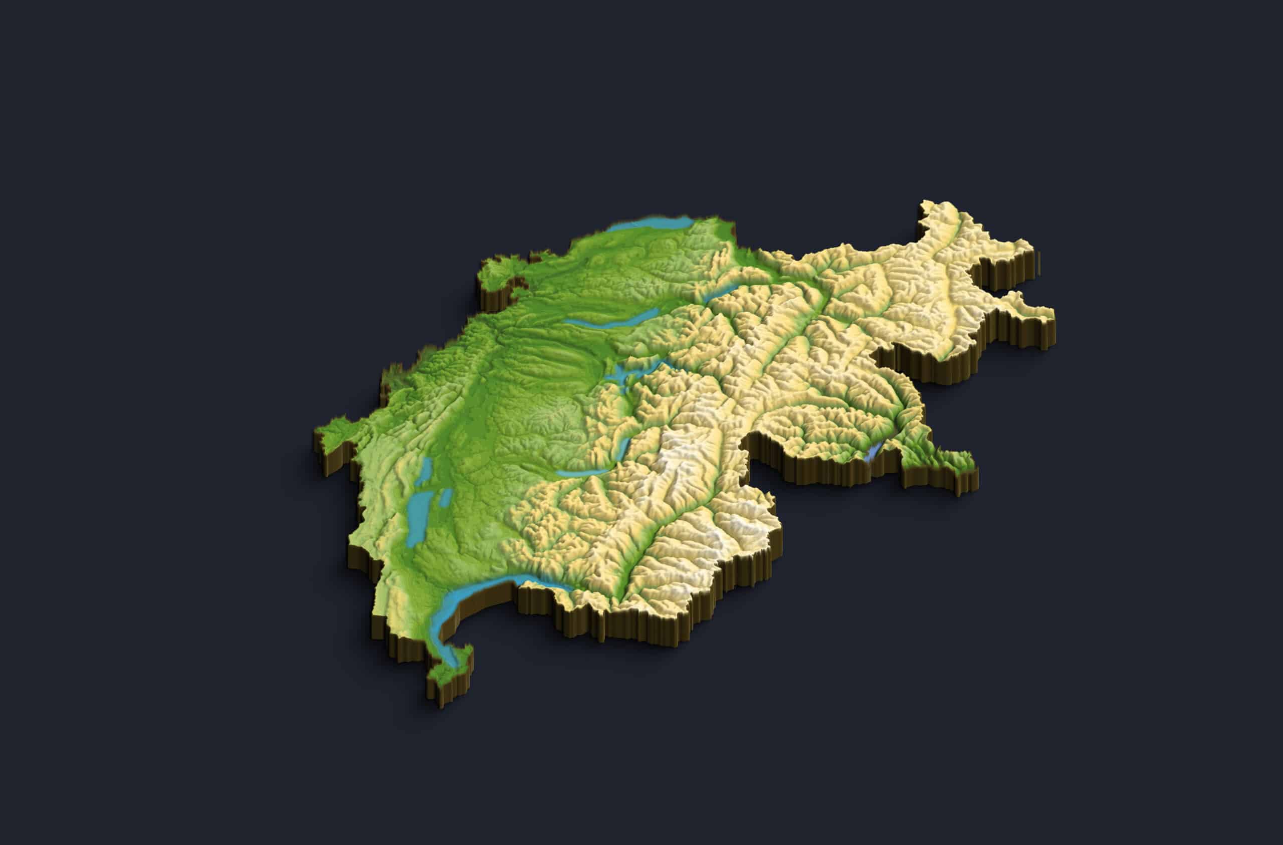
Topography & Elevation Mapping
Understand your land at a deeper level with precise elevation models. Our 3D maps highlight slopes, low spots, and contours that influence drainage, erosion, and crop performance, helping you make informed decisions before problems arise.
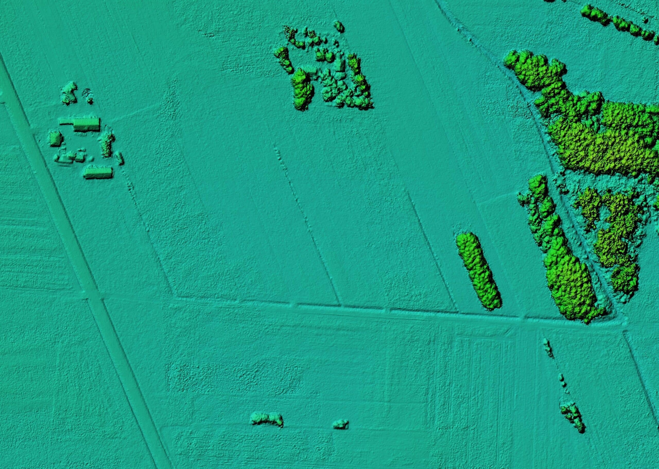
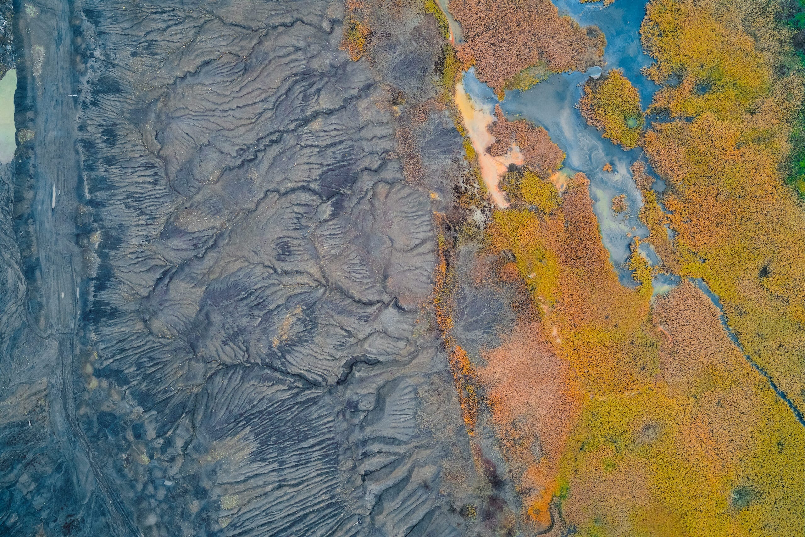
Drainage & Water Flow Analysis
Identify how water moves across your fields during rainfall and irrigation events. Drone-generated 3D terrain data helps pinpoint pooling areas, runoff paths, and drainage challenges, supporting better tile placement and water management strategies.
Field Planning & Land Development
Plan field improvements with confidence. Aerial 3D mapping supports accurate measurements for earthmoving, grading, terraces, and infrastructure placement, reducing guesswork and costly rework during land development projects.
Our services
Contact Us
follow us on
Customer Questions
What deliverables are included with 3D mapping?
Deliverables typically include high-resolution orthomosaic maps, digital surface models, digital elevation models, and 3D point clouds, depending on project needs.
How accurate is drone-based 3D mapping?
Our mapping is highly accurate, often within centimeters, depending on flight conditions, ground control, and project specifications.
How long does a typical mapping project take?
Most agricultural mapping projects can be completed in 1–2 days, weather permitting, with processed deliverables provided shortly after flight.
Can these maps be used with farm management software?
Yes. Most outputs are compatible with common GIS, CAD, and farm management platforms.
Is drone mapping more cost-effective than traditional surveying?
In many cases, yes. Drone mapping covers large areas quickly, reduces labor costs, and minimizes disruption to active fields, while still delivering detailed, usable data.